
Pipeline routing and maps
The proposed pipeline corridor is split below into three sections:
- Section 1: Drax area to the River Trent
- Section 2: River Trent to the Humber
- Section 3: Humber to the coast north of Easington
Each section page explains the proposed pipeline route, Above Ground Installations, and construction traffic routes for each section of the pipeline.
More detail about how we intend to construct the project can be found on our website HERE.
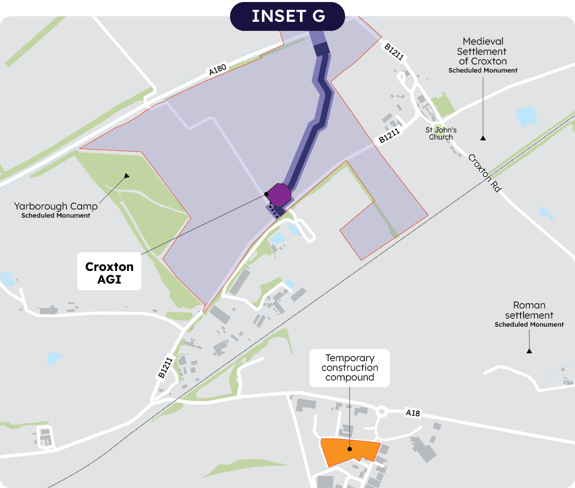
Our latest maps, presented at the 2025 statutory consultation, show our evolved proposals. The maps show draft Order Limits, indicated by a red line. The draft Order Limits represent the extent of the area within which we currently expect the project may be carried out.
The draft Order Limits are typically 300m wide, but in some locations are wider to allow for design flexibility. As the project progresses, we anticipate narrowing the Order Limits.
In addition to the draft Order Limits our updated maps also show:
- Indicative pipeline construction area (shown dark purple on the map)
We show a corridor within which we currently expect the pipeline to be positioned and where we expect to undertake our main construction activities. This is typically around 30m wide, but wider to allow more space where the pipeline crosses features like rivers or roads. This alignment is subject to change in response to consultation feedback or other factors. In some locations, there is no pipeline construction area shown as these are areas where we are considering alternative crossing methods and design is ongoing. - Indicative Limits of Deviation (shown mid purple on the map)
The pipeline and associated works may be constructed anywhere within the indicative limits of deviation. For example we might use this land to reposition the pipeline if we come across issues or constraints during construction. - Area between Limits of Deviation and draft Order Limits (shown light purple on the map)
The indicative construction area and Limits of Deviation may at this stage deviate anywhere within this area based on consultation responses and further investigations. The DCO application will show a final construction area and Limits of Deviation. Land which is outside of the indicative Limits of Deviation but within the draft Order Limits land could be used for construction activity, ancillary or additional works, for example for power supply, to string the pipeline or undertake drainage works.
Please note, all of the limits shown in the consultation maps may be varied in the final application version of the Order Limits following consultation feedback and further design refinement. In particular, further access routes and works for access outside these draft Order Limits may be provided for.
Section 1: Drax to the eastern bank of the River Trent
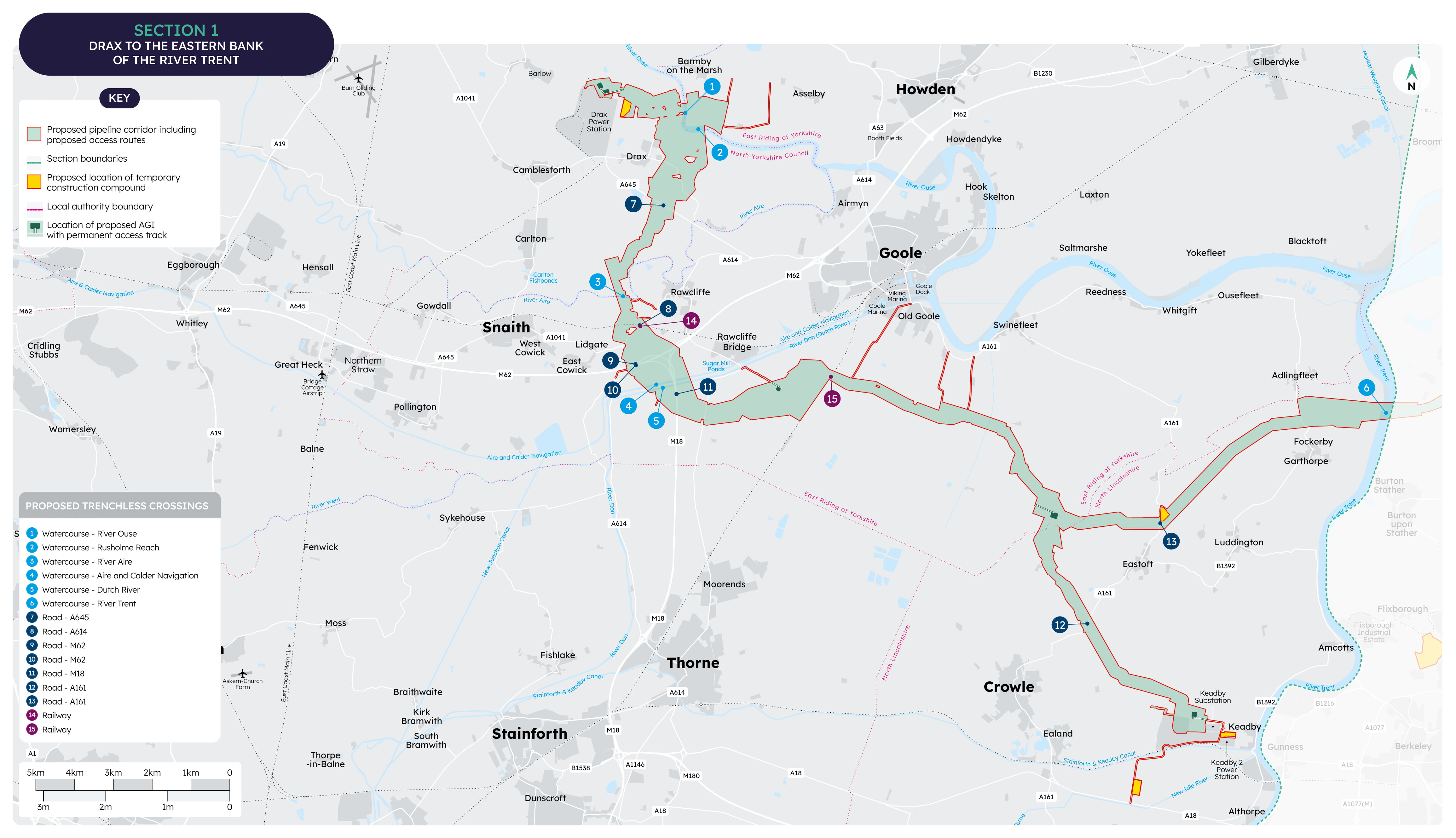
Section 1 extends from the Drax area to the River Trent. The western part of this section is within North Yorkshire whilst the middle part is in the East Riding of Yorkshire and the eastern part is within North Lincolnshire.
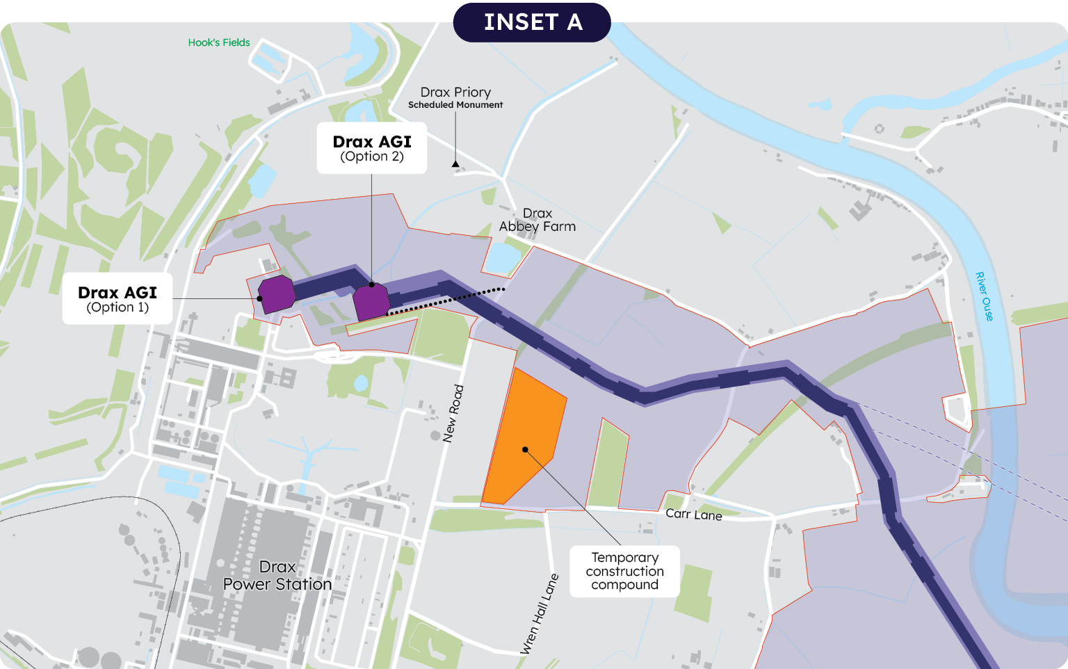
Two possible locations for an AGI are identified near Drax; one within the boundary of Drax Power Station, and the other in the agricultural fields to the north of Drax Power Station.
To the east of Drax the pipeline heads south, passing to the east of Drax village, but staying west of the River Ouse. The alternative would be to cross the River Ouse twice in quick succession, but this would be challenging from an environmental and engineering perspective. Whilst the draft Order Limits remain wide here to allow for flexibility, we envisage them shrinking down for the DCO application.
Continuing south, the proposed pipeline passes west of Rawcliffe and under the River Aire and the Wakefield and Goole railway line.
The proposed pipeline continues in a southeasterly direction and is expected to cross the Aire and Calder Navigation canal, the Dutch River (River Don) and the M18 in a single trenchless crossing.
The proposed Humber Freeport – Goole development site constrains the more direct route to the east.
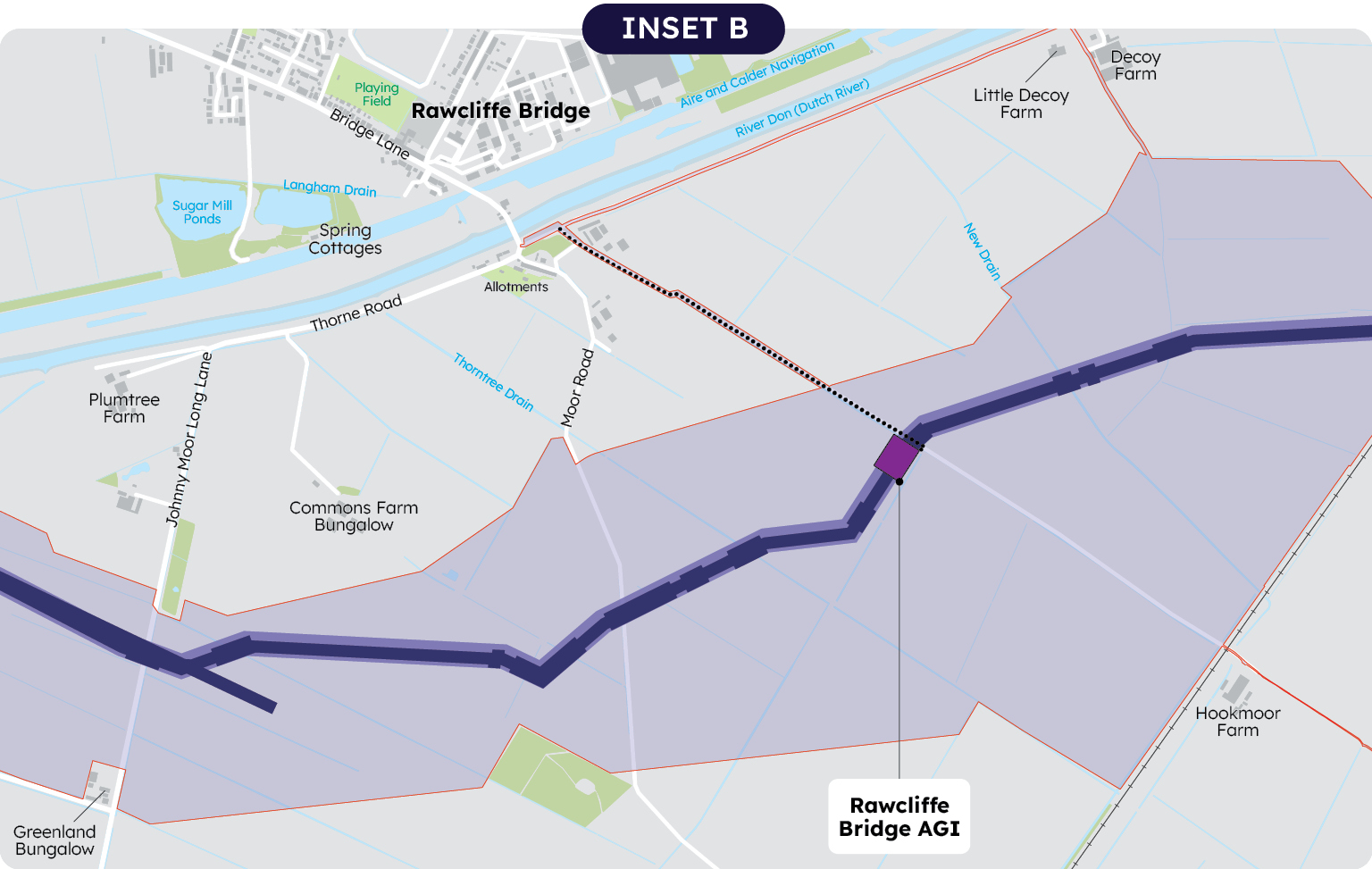
An AGI is proposed north of Moor Road, south of Rawcliffe Bridge.
The proposed pipeline corridor then crosses under the railway and continues through the agricultural area of Goole Fields, adopting a straighter alignment than proposed in the Summer 2024 non-statutory consultation.
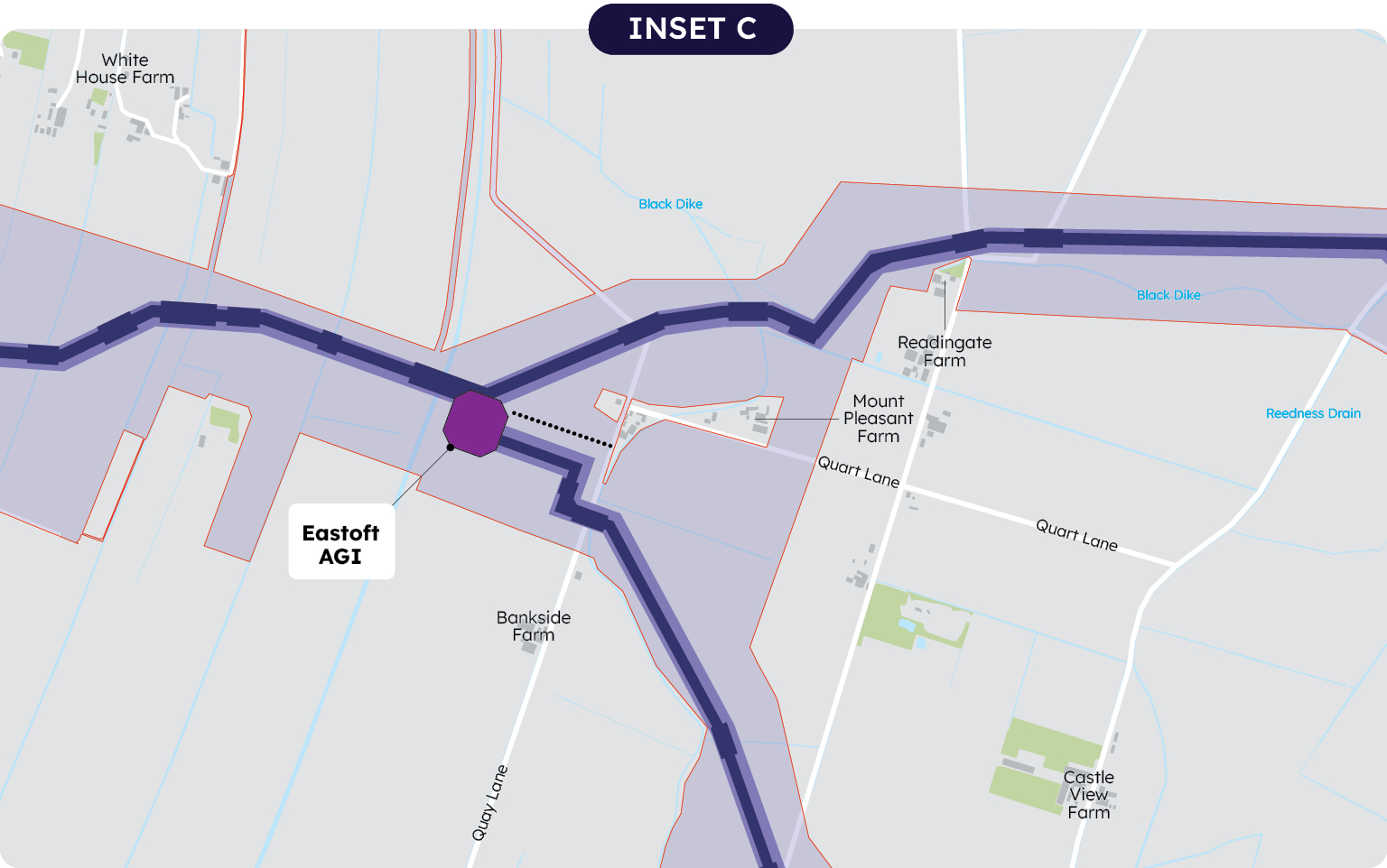
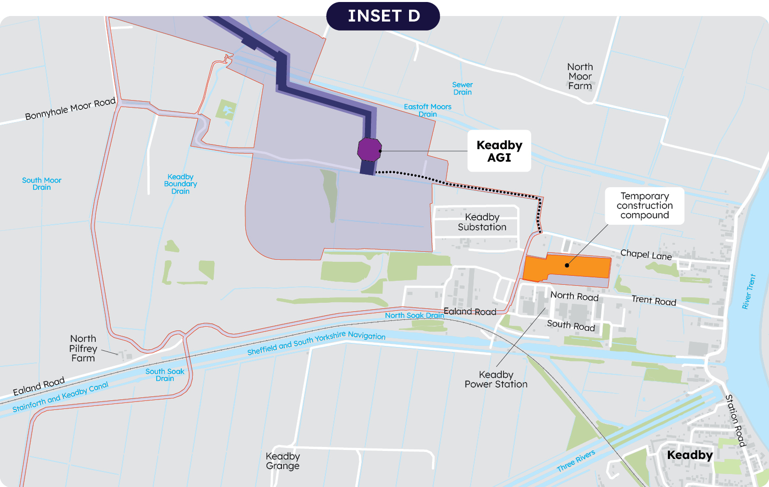
South of Swinefleet and immediately east of Swinefleet Warping Drain, an AGI would be required within the agricultural field near Eastoft– this will connect to a spur line. The spur line routes south crossing the A161 between Crowle and Eastoft, to Keadby, where a further AGI would be required.
The main pipeline corridor continues eastwards through fields crossing the A161 north of Eastoft, and go on to cross the River Trent between Adlingfleet and Garthorpe. Here, the draft Order Limits were adjusted following non-statutory consultation feedback to avoid the RSPB Island Farm Nature Reserve to the north.
More information about each AGI in this section can be found on pages 20 to 21 of the statutory consultation project brochure HERE
Construction compounds
In this section four temporary construction compounds are proposed:
- To the east of Drax Power Station
- To the east of Keadby Power Station
- South of Keadby off the A18
- North of Eastoft on the A161
Routes for construction traffic
Within section 1 a number of roads are included in the draft Order Limits where we anticipate they may require some modifications to support construction traffic.
We have also identified a range of other possible roads which our construction traffic could use.
Section 2: River Trent to the Humber
Section 2, from the River Trent to the Humber, is largely within North Lincolnshire, with a small section extending into North East Lincolnshire.
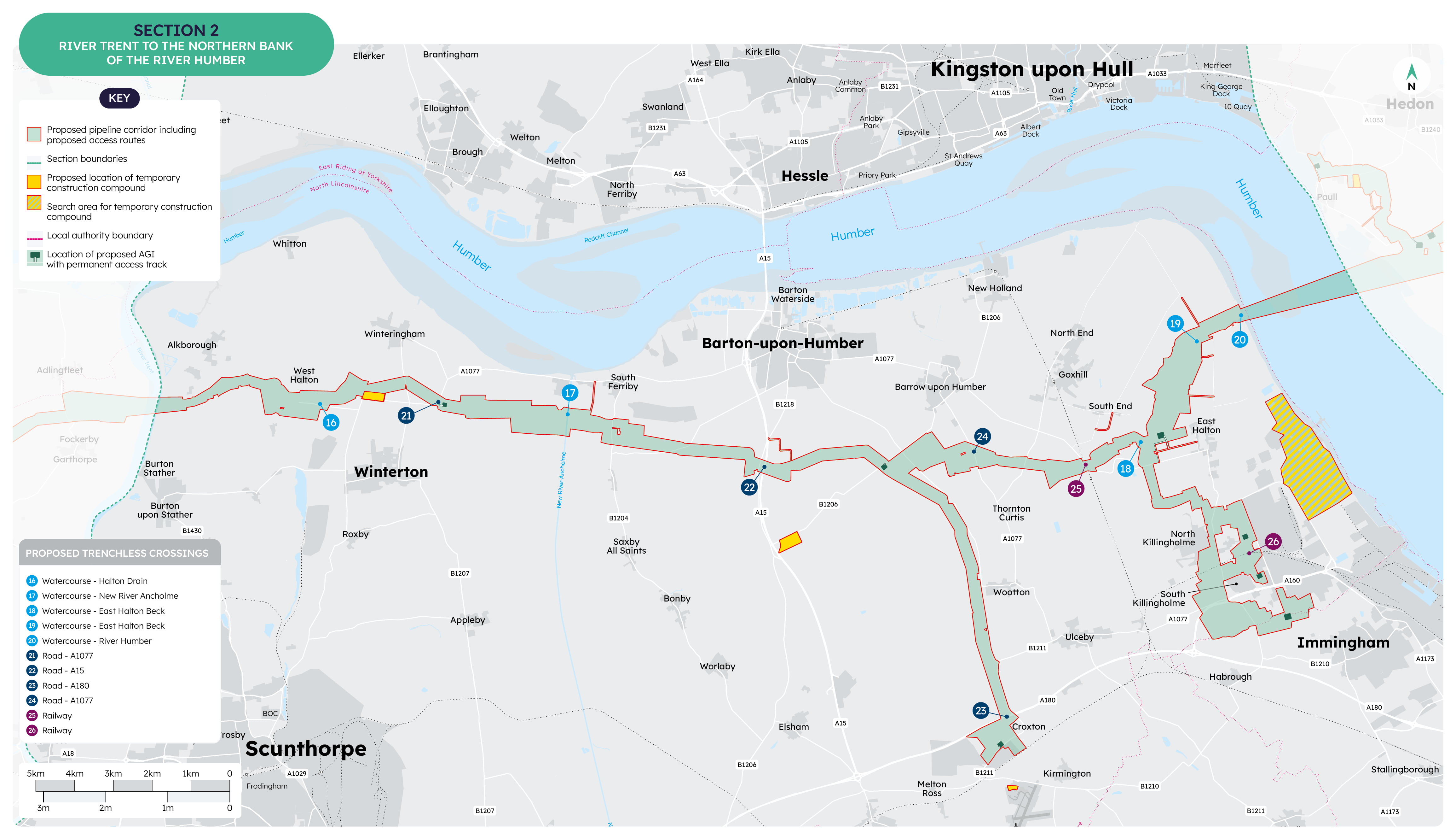
From the crossing of the River Trent, the draft Order Limits run eastwards between Walcot and Burton upon Stather, avoiding the area known as Alkborough Flats, a Local Wildlife Site.
The route would pass south of Coleby and south of West Halton. The pipeline would stay north of the Winterton landfill site. The draft Order Limits are wide to retain optionality, but routeing south under the landfill would present significant technical challenges. Whilst the draft Order Limits remain wide here we envisage them shrinking down for the DCO application.
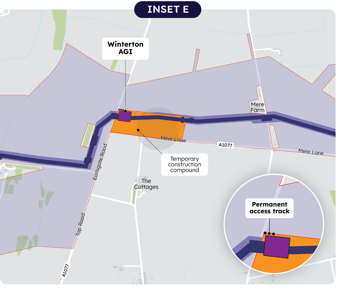
An Above Ground Installation (AGI) is proposed north of the A1077 between Winterton and Winteringham.
The draft Order Limits cross the A1077 and pass south of South Ferriby where they cross New River Ancholme.
Further east, the pipeline would cross trenchlessly under the B1218 and the A15 and pass south of Barton-Upon-Humber.
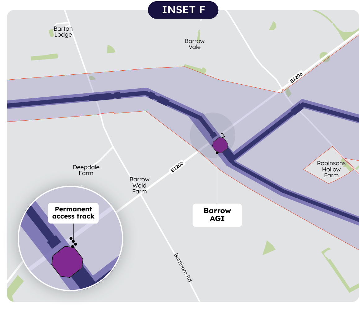
South of Barrow-Upon-Humber, an AGI is proposed to enable a spur line to go south passing to the west of Thornton Curtis, Wootton and Ulceby to allow connection to Croxton. Here, an AGI is proposed in the agricultural field between the B1211 and the A180 to enable connection to potential future carbon capture projects.
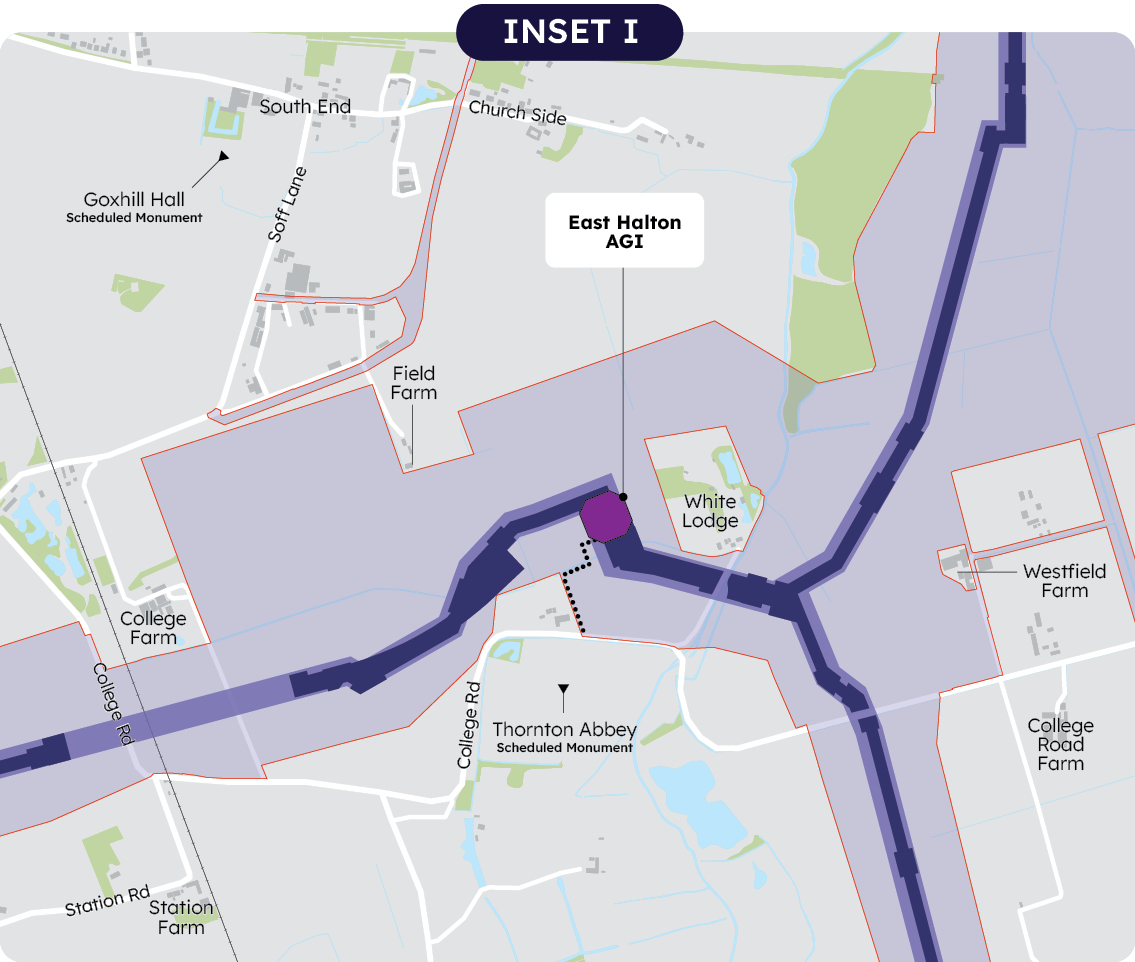
The main route continues east, passing under the A1077 and the railway and then going south of Goxhill and South End. An AGI is proposed within the agricultural fields north of College Road, near East Halton. This AGI location was moved further west and further from East Halton than was proposed at non-statutory consultation stage to move it away from the village and to improve access during operation.
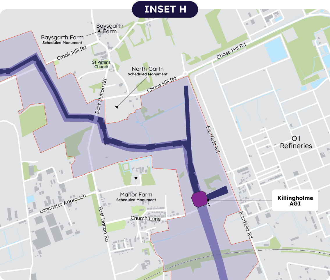
From the East Halton AGI, a spur line runs south to allow a possible connection to potential carbon capture projects in the North Killingholme and South Killingholme area.
East of North Killingholme a single AGI is now proposed off Church Lane to facilitate connection to potential carbon capture projects in the Killingholme area. Two AGIs were proposed at non-statutory stage but have been reduced to one AGI (but this would fulfil the same function).
The proposed spur line crosses Church Lane and continues south to South Killingholme.
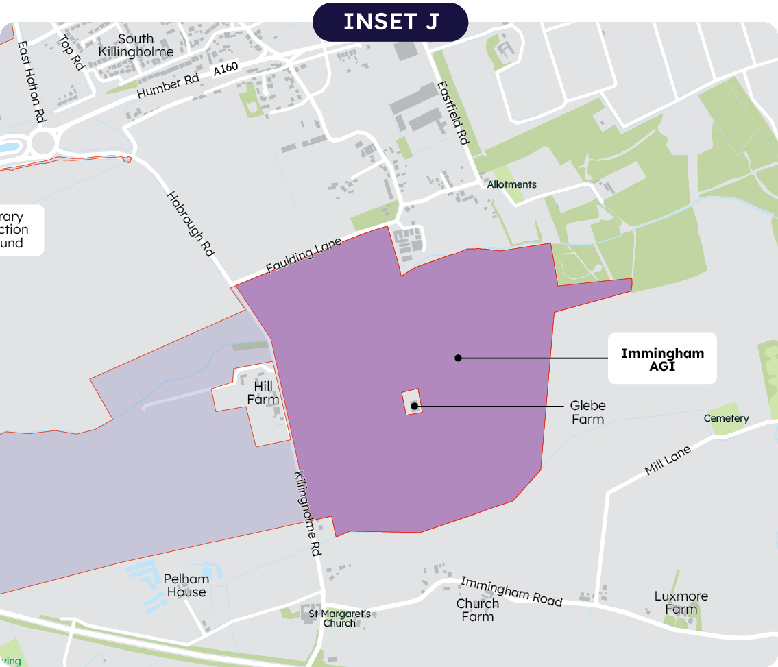
To facilitate a possible future optimisation of the carbon dioxide gathering networks, the draft Order Limits extend around the west of South Killingholme, and continue south, to the A180. Consideration of whether or not this should be part of this scheme are ongoing. Accordingly, this section does not yet have an indicative pipeline construction area indicated. If this is progressed as part of this scheme this will be identified for the DCO application. This section may also require an AGI, and accordingly a ‘search area’ is proposed near Immingham, south of South Killingholme and the south of Faulding Lane.
The draft Order Limits now avoid the recently consented data centre. Following local feedback, the route has also been amended since non-statutory consultation stage to avoid Mayflower Woods.
From the East Halton AGI the main pipeline continues north, passing between Goxhill and East Halton. The main works area for the Humber crossing will be between East Marsh Lane and Skitter Road. As previously noted, the pipeline would cross the Humber either using HDD or in a tunnel.
More information about each AGI in this section can be found on pages 24 to 25 of the statutory consultation project brochure here
Construction compounds
In section 2, five temporary construction compounds are shown:
- North of Winterton, north of the A1077
- South of Barton upon Humber, off the B1206 (Beaumontcote)
- West of South Killingholme, off the A18 near Humberside Airport
- An ‘area of search’ at South Killinghome, near the docks.
- West of South Killingholme, of the A1077 Ulceby Road.
Routes for construction traffic
Within section 2 a number of roads are included in the draft Order Limits where we anticipate they may require some modifications to support construction traffic. Other roads are highlighted as potential routes to be used by construction traffic.
A number of options are shown in the East Halton and Goxhill area and are described in the PEIR. This is because the Humber crossing works will have different access requirements depending on whether the HDD or tunnel method is used.
If HDD is used, the preferred route for HGVs would be via a one-way system accessing the main works site via Ferry Road and East Marsh Road and leaving via Skitter Road, Station Road and Townside. This route is the same as we have proposed for the trial HDD.
If a tunnel is needed, overall volumes of traffic would be greater. We envisage using a one-way system via Ferry Road, East Marsh Lane and Chapel Field Road and constructing a new connection at South End to avoid traffic using Church Side.
Section 3: Humber to the coast north of Easington
Section 3 continues from the north bank of the Humber near Paull and Thorngumbald, through to the coast north of Easington. This section is entirely within the East Riding of Yorkshire.
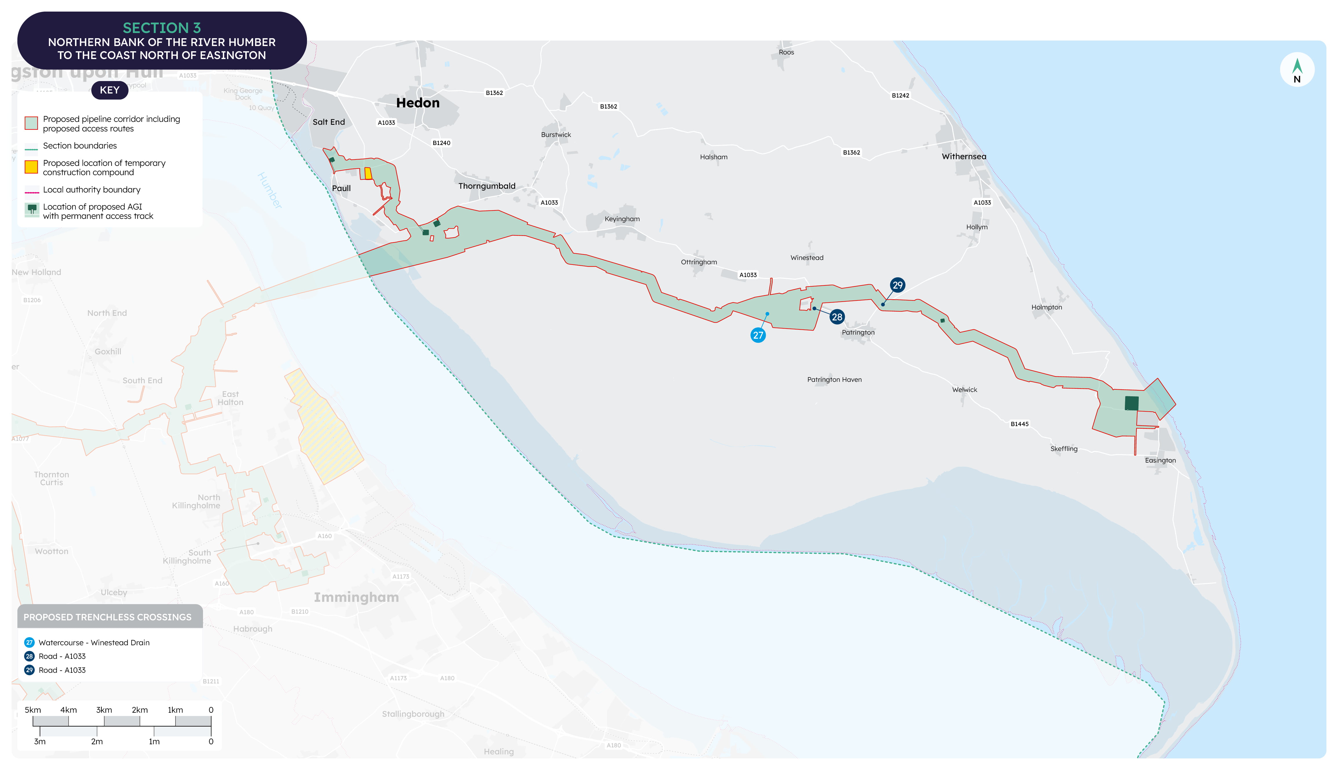
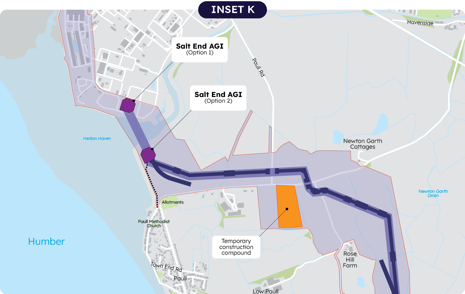
On the north bank we would set up a construction compound for the Humber crossing. This would be south west of Dark Lane.
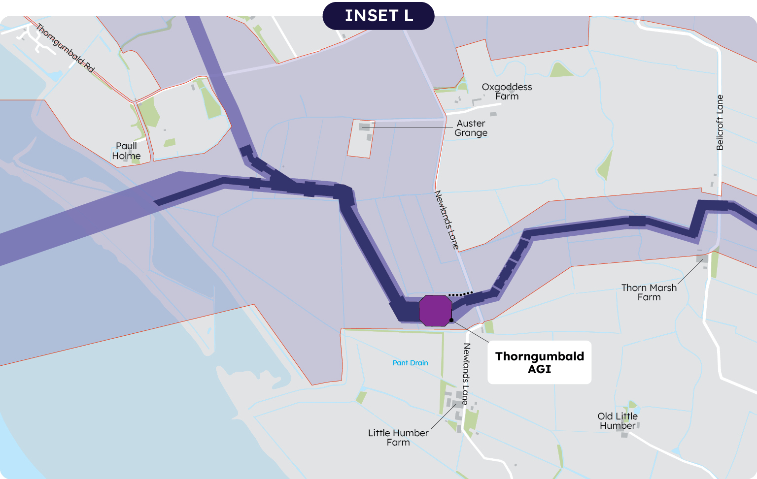
The draft Order Limits on the north bank and to the south west of Thorngumbald have evolved since our last consultation and we are now proposing an AGI further south, off Newlands Lane. This AGI would allow a spur to go north, to continue to provide a connection to the Salt End Chemicals Park.
At Salt end, two options for an AGI are identified. One option is within the Salt end Chemicals Park itself, the other is further south.
From the crossing of the River Humber, the draft Order Limits continue east running south of Thorngumbald, Keyingham and Ottringham.
South of Thorngumbald the draft Order Limits are wide to provide two corridors. The northern area, which does not have a pipeline construction area shown, would be used only for temporary works to enable stringing the pipeline.
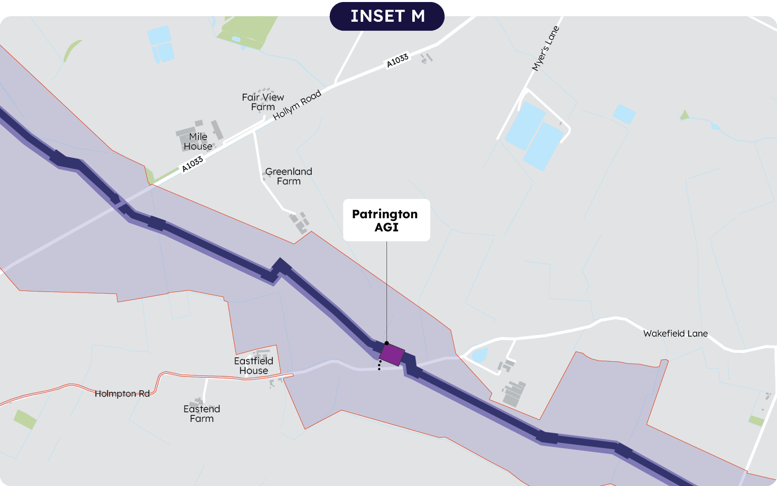
An AGI is proposed between Patrington and Holmpton, in the agricultural fields to the north of Wakefield Lane.
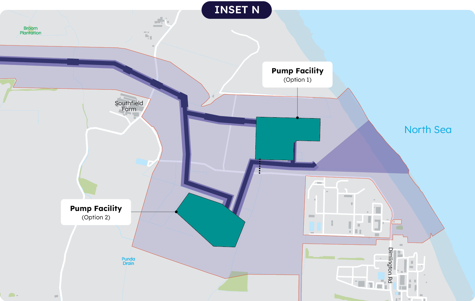
North of the village of Easington, the proposed pipeline corridor connects to the Pump Facility which will transport the carbon dioxide offshore. Two locations are being considered, one to the north of the gas processing site and one to the west. One will be selected for the DCO application.
At the coast we are considering four different methods of routeing the pipeline under Dimlington Cliffs and the beach so that it can connect to the offshore pipeline. The methods would employ different technologies and have different impacts. The PEIR provides more details.
We will seek consent for the pipeline up to Mean Low Water Springs, beyond this point the pipeline out to sea and other infrastructure would be separately consented and are not part of this proposal.
More information about each AGI in this section can be found on pages 28 to 29 of the statutory consultation project brochure here
Construction compounds
In this section two temporary construction compounds are identified:
- Saltend / North East of Paull
- Winestead, off the A1033.
Routes for construction traffic
Within section 3 a number of roads are included in the draft Order Limits where we anticipate they may require some modifications to support construction traffic. Other roads are highlighted as potential routes to be used by construction traffic.
A number of options are shown in the Paull and Thorngumbald area to serve the works to facilitate the Humber crossing.
Subject to agreement it is proposed to use a private track through Rose Hill Farm to reduce flows through the villages. This is the same route we propose to use for the trial HDD.