
North Humber planning application (East Riding)
Site location
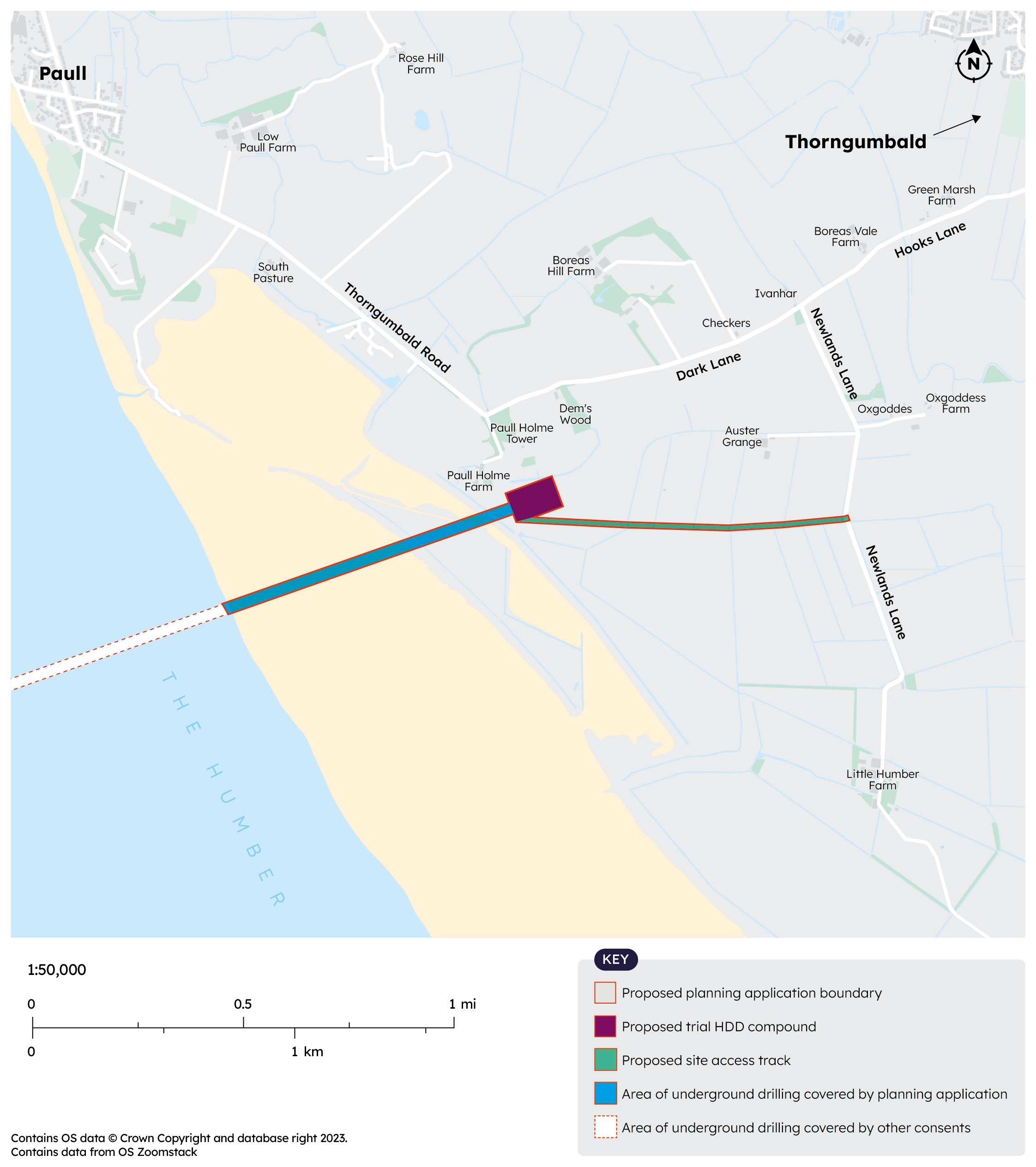
Map 3 shows the location of the proposed compound on the north side, near Dark Lane and Newlands Lane. It is located back from the sensitive estuary habitat.
The map also shows the access track we will need to create to connect the compound to Newlands Lane.
Map 3
Routes for construction traffic
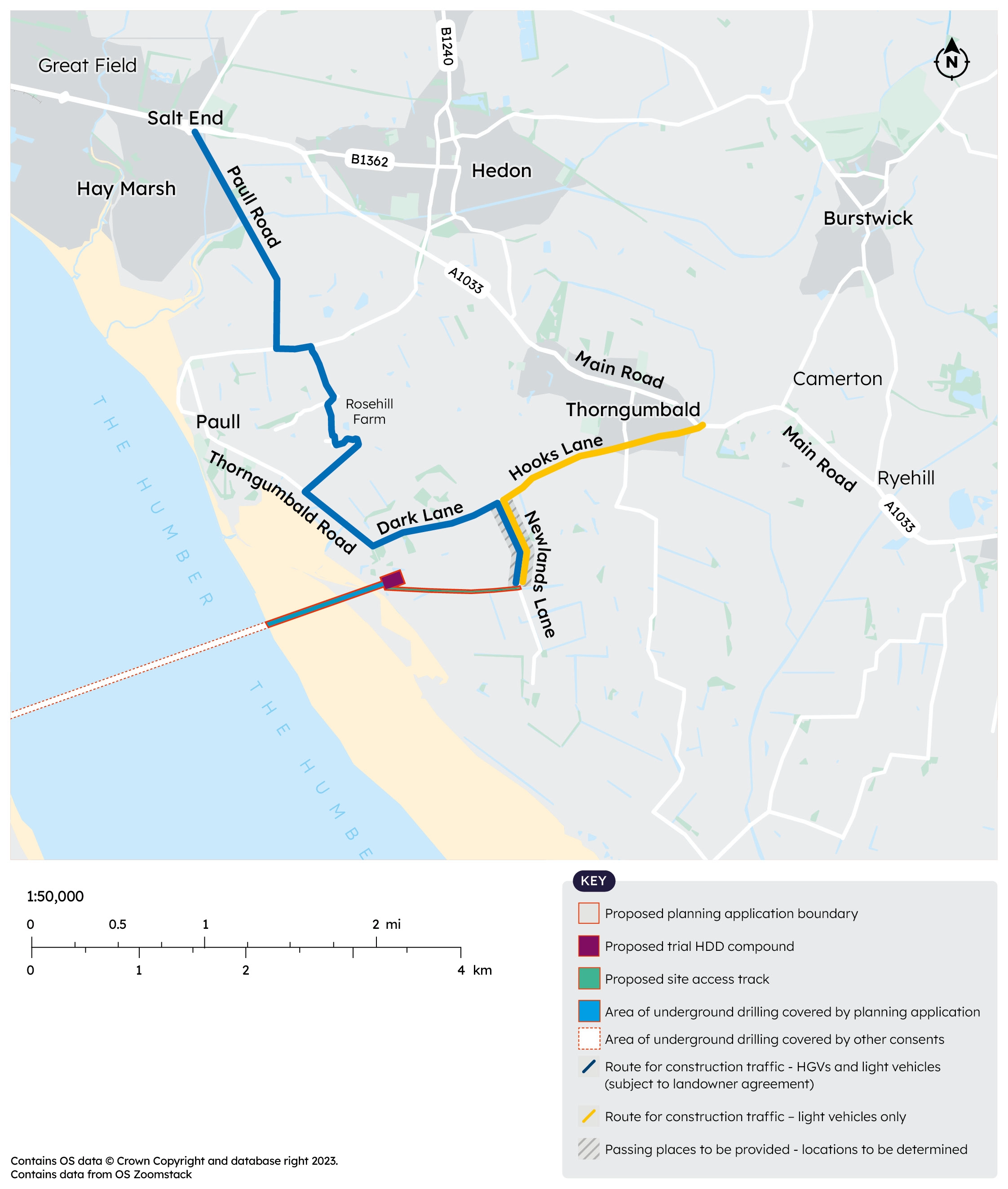
Subject to landowner agreement we propose that our Heavy Goods Vehicles (HGVs) will use Paull Road and the existing track through Rose Hill Farm then Thorngumbald Road, Dark Lane and Newlands Lane. If it is not possible to use the Rose Hill Farm track our HGVs would use Hooks Lane to get access to A1033.
Light traffic will also be encouraged to use the Rose Hill Farm route (but would be permitted to use Hooks Lane to A1033 if required).
Map 4
Amount of construction traffic
On an average day we anticipate 10 HGVs will need to access the compound. Occasionally, for example when we have to bring in equipment, there may be more. The maximum number of HGVs required on a peak movements day would be around 23-24. We only expect these levels on around 14 days.
Around 9 light vehicles would need to access the compound per day on average. The maximum number of light vehicles on any one day would be around 17.
At this stage, the numbers of HGVs include for the possible need to bring in water by tanker. However, we are looking at other water supply options which we hope will help to reduce the number of vehicles.
Improvements to local roads
We will put in new passing places on Newlands Lane to ensure traffic can safely pass. These may be left in place permanently.
Keep updated
Register here for project updates related to the HDD trial and the Humber Carbon Capture Pipeline.